Physical Oceanography
Type of resources
Keywords
Publication year
Topics
-
A fully four-dimensional (3D x time) open source (BSD-3), object-oriented biophysical dispersal model was developed to simulate the movement of marine larvae over semi-continuous surfaces. The model is capable of handling massive numbers of simulated larvae, can accommodate diverse life history patterns and distributions of characteristics, and saves point-level information to a relational database management system. The model was used to study Australia's northwest marine region, with attention given to connectivity patterns among Australia's north-western Commonwealth Marine Reserves (CMRs). This work was supported by the Marine Biodiversity Hub through the Australian Government's National Environmental Research Program (NERP).
-
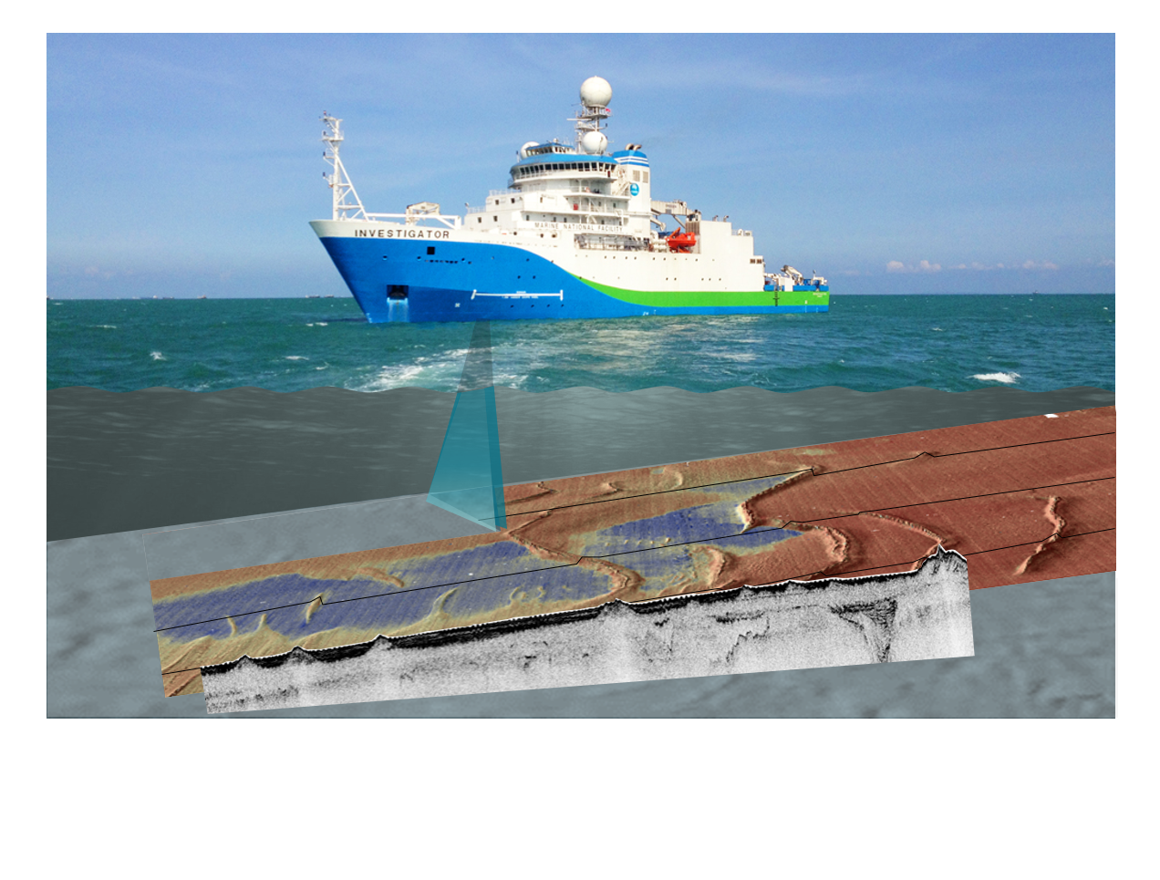
Have you ever wondered how we know the depth of the ocean? Sonar is the main technology used investigate the location of submarine canyons, seamounts, abyssal plains and if the seafloor is sand or rock. This activity builds understanding of sonar technique and applications through a) processing and plotting provided data to discover a seafloor feature or shipwreck, and b) bouncing balls on different surfaces and analysing rebound, relating this to ground hardness then extend understanding to ‘backscatter’ in bathymetry surveys. It is suitable for middle secondary students, but could be extended for senior students of Earth science, marine science/oceanography, and physics.